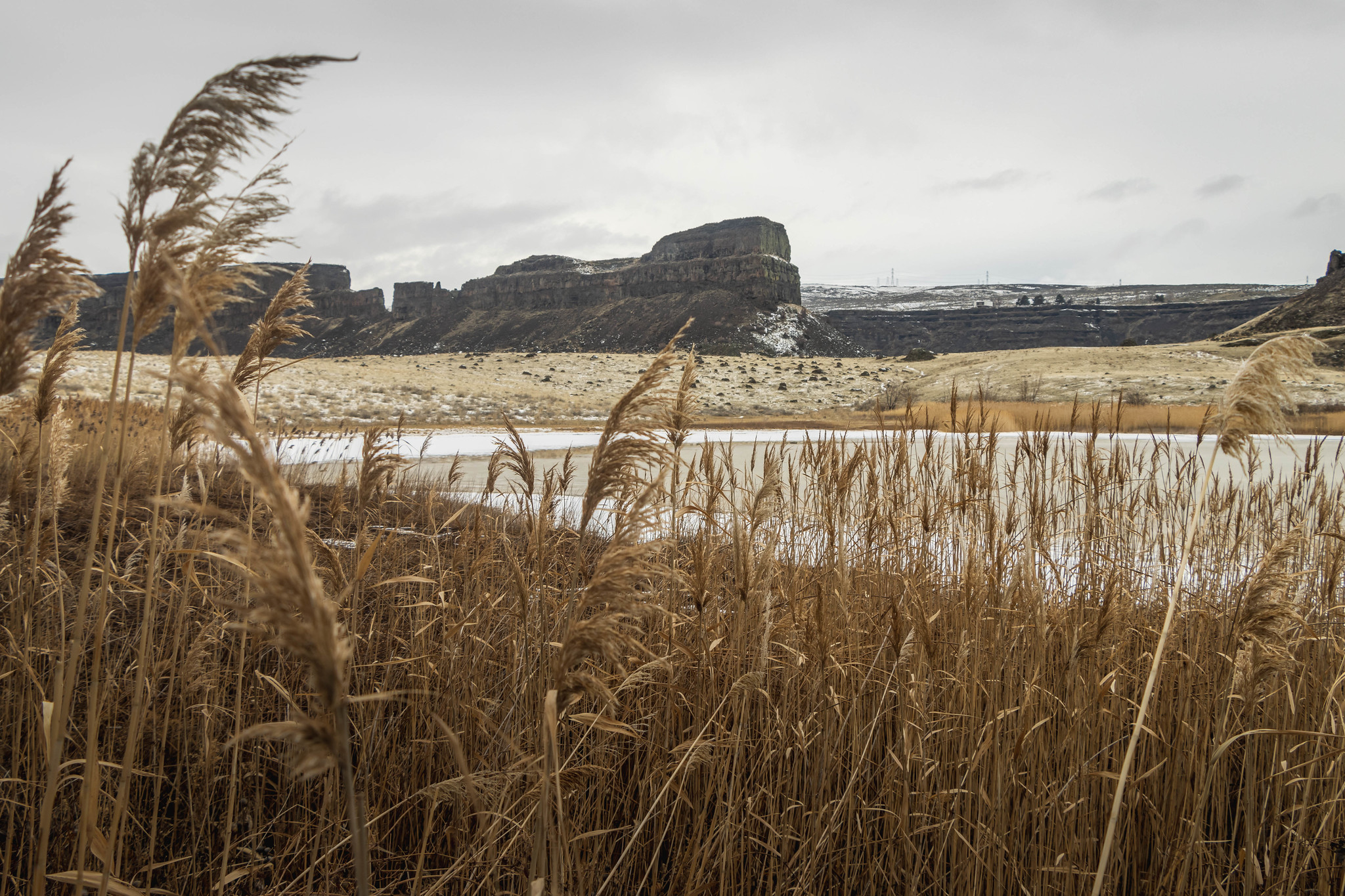
Umatilla Rock is the centerpiece of Monument Coulee. The main trail around the feature is nearly three miles plus lake views. But the best place to see the coulee is above the rock itself.

See more trip photos here.
Monument Coulee and Umatilla Rock at a Glance
Access: Umatilla Rock Trailhead
Round Trip: 6.5 miles
Elevation Range: 1100′-1280′
Gear: none
GPS Track: available
Dog-Friendly: yes
The Day After New Year’s Day
We spent yesterday in the Yakima area to escape from the lousy mountain weather. Though, today’s conditions over mountain passes were still the same. So we spent another day out east.
I had wanted to seek out a new hike nearby. But the two places I found online ended up being inside private property. So after driving aimlessly in the area for a while, we came to my favorite coulee.

See more trip photos here.
Monument Coulee and Umatilla Rock
We arrived at the gated State Park Road in the late morning. Then we walked 1.5 miles to the summer parking lot over a dusting of snow. Our first stop was Green Lake. Then we’d check out Red Alkali Lake to see if there’s water in it.
Later we went counterclockwise on the Umatilla Rock Trail. Then halfway to the lake, we crossed Delany Spring and went on the unnamed path. Before long, we were up by Green Lake.
See more trip photos here.
Dry Falls Lake
From the south shore, we walked around the water via the rocks below the basalt columns. The path was rocky and brushy. But soon, we reached the north shoreline with views out to the coulee. Umatilla Rock sat front and center.
Later we finished circling the lake and went back on the main trail. Then we crossed over Umatilla Rock’s northeast. Soon, Dry Falls Lake came into view. The flat area above the cliffs was one of the few places to get a good view.

See more trip photos here.
Perch Lake
Our late start didn’t leave much time to explore. So I largely focused on taking some video footage. Down by the public toilet, we went on the road toward Perch Lake. Birds chirped incessantly throughout the afternoon.
As we strolled by the big boulders, we heard noises from the visitor center up by the highway. The large groups of waterfowl must’ve sensed our presence before they saw us. By the time we arrived, they had swum across the water.

See more trip photos here.
Outro
Since we got a late start, we didn’t spend much time looking around. But it was our seventh time here. So we’ve probably seen most things. I’ve always marveled at the sight of the big rocks at the heels of Umatilla Rock.
Later we completed the loop out by the trailhead. Then on our way out, I chatted with two bikers who had just come from Deep Lake. The pups went and chased after them, of course.

See more trip photos here.