It’s easy to overlook Tumwater Mountain because of its shorter stature. But it also doesn’t help when the taller Icicle Ridge is just next door. The mountain blends into the backdrop of Leavenworth entirely. So it seems to hide in plain sight.
See more trip photos here.
Tumwater Mountain at a Glance
Access: NF-7701
Round Trip: TBD
Elevation Range: 1400′-4480′
Gear: none
GPS Track: available
Dog-Friendly: yes
Road 7701 to Eastern Slopes
We walked through the gate and then hiked to the first road bend. Then the pups and I went straight up the steep eastern slopes. It was brushy in places lower down. But we higher up were more down trees.
After going through the windfalls, we made it up on the ridge. Then it was just an easy northbound traverse up to the woodsy summit. Despite having soft snow, I didn’t need to use snowshoes.
See more trip photos here.
Tumwater Summit Plus Outro
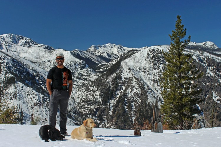
East of the summit had the least number of trees. But the forest had obscured our view to the north. So we continued north through the ridgetop. Shortly, we broke out into a clearing.
The tall neighboring Icicle Ridge had blocked the views to The Enchantments. But I could still see the top of Big Lou Mountain and Big Jim Mountain to the west. We left the summit after an extended break.
See more trip photos here.